Calderdale Metropolitan Borough Council
Tree preservation zone
There is a problem
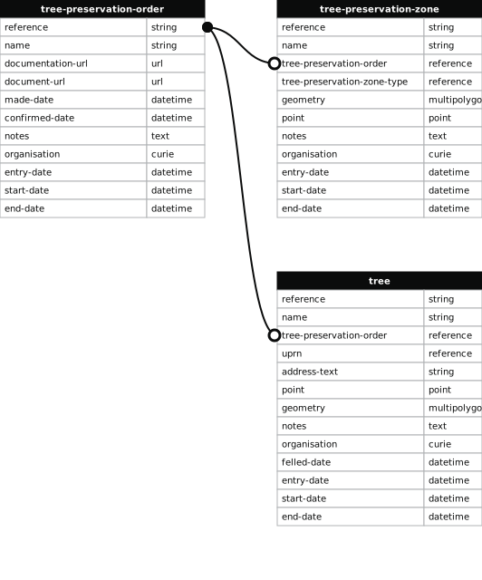
- 25 entries with tree-preservation-order field must match the reference field in the tree preservation order dataset
Land Adj To 192 Rochdale Road, Triangle
- reference
- 89/00406/C
- name
- Land Adj To 192 Rochdale Road, Triangle
- tree-preservation-order
- 89/00406/C
- tree-preservation-zone-type
- group
- geometry
- MULTIPOLYGON (((-1.930210 53.699823,-1.930204 53.699852,-1.930131 53.699879,-1.930203 53.699937,-1.930270 53.699909,-1.930285 53.699898,-1.930294 53.699890,-1.930301 53.699879,-1.930304 53.699873,-1.930308 53.699852,-1.930308 53.699840,-1.930305 53.699826,-1.930228 53.699722,-1.930221 53.699698,-1.930224 53.699670,-1.930105 53.699711,-1.930210 53.699823)))
- point
- POINT (-1.930217 53.69981)
- notes
- Sycamore, chestnut
- entry-date
- 1989-07-14
- start-date
- 1989-07-14
- end-date
How to fix this issue
Your data is missing a tree-preservation-order.
The tree preservation zone guidance explains how to fix the issue:
tree-preservation-order
The reference for the tree preservation order that covers this zone.
How to improve Calderdale Metropolitan Borough Council’s data
- Fix the errors indicated
- Use the check service to make sure the data meets the standard
- Publish the updated data on the endpoint URL